미리보기 크기: 800 × 533 픽셀 다른 解像度 : 320 × 213 픽셀 | 640 × 427 픽셀 | 1,024 × 683 픽셀 | 1,280 × 853 픽셀 | 3,000 × 2,000 픽셀
原本 파일 (3,000 × 2,000 픽셀, 파일 크기: 2.8 MB, MIME
Summary
| Description |
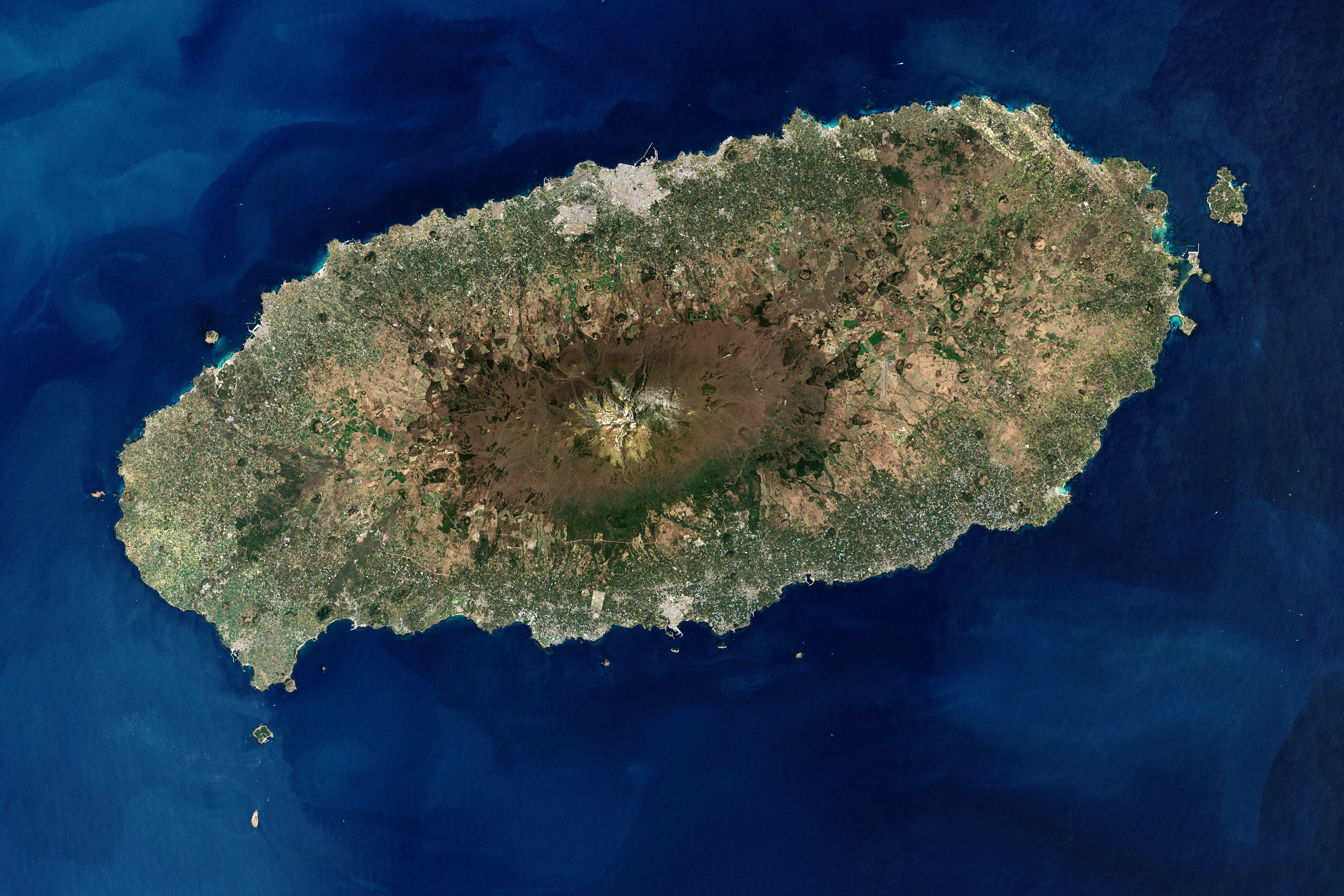
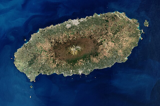
English: Jeju Island
Español: Vista satelital de Jeju, una isla volcánica de Corea del Sur ubicada en el estrecho de Corea.
Français : Vue satellite de l'île de Jeju, la plus grande île de Corée du Sud.
한국어: 제주도
中文:濟州島
فارسی: نگاره ماهوارهای از جزیره چجو
Esperanto: Satelita vido de la insulo Jeju, la plej granda insulo en Suda Koreio.
|
| Date | |
| Source | Earth Observatory |
| Author | Robert Simmon, using Landsat data provided by the United States Geological Survey. |
| Other versions | Derivative works of this file: Cheju etm 2000097 lrg-2.jpg |
|
This image was selected as picture of the day on Wikimedia Commons for 7 February 2015. It was captioned as follows: Other languages:
Esperanto: Satelita vido de la insulo Jeju, la plej granda insulo en Suda Koreio. Français : Vue satellite de l'île de Jeju, la plus grande île de Corée du Sud. |
Licensing
| This file is in the public domain in the United States because it was solely created by NASA. NASA copyright policy states that "NASA material is not protected by copyright unless noted". (See Template:PD-USGov, NASA copyright policy page or JPL Image Use Policy.) | ||
 |
Warnings:
|
파일 歷史
날짜/
| 날짜/時間 | 섬네일 | 크기 | 使用者 | 說明 | |
|---|---|---|---|---|---|
| 現在 | 2008年11月18日(火)23時00分 | | 3,000 × 2,000 (2.8 MB) | wikimediacommons>Jyusin | {{Information |Description={{en|1=Jeju Island}} {{ko|1=제주도}} {{zh|1=濟州島}} |Source=[http://earthobservatory.nasa.gov/IOTD/view.php?id=35900 Earth Observatory] |Author=NASA |Date= |Permission= |other_versions= }} <!--{{ImageUpload|full}}--> |
이 파일을 使用하는 文書
다음